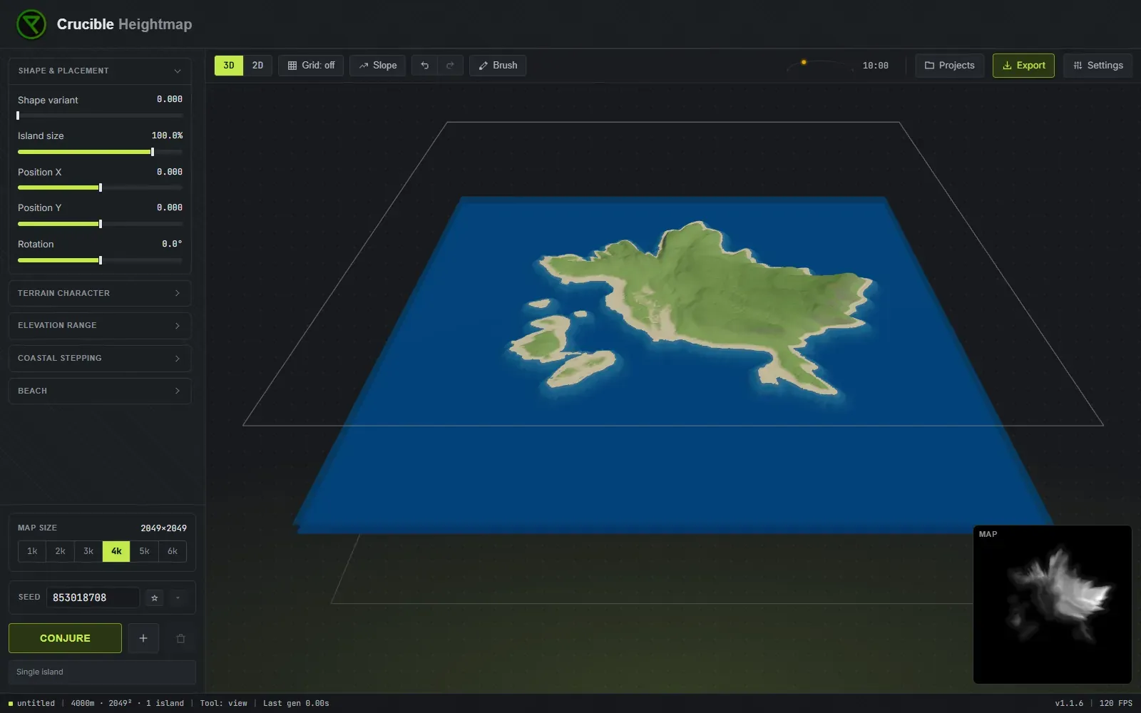
Live 3D preview
Crucible shows your terrain in a live 3D preview that updates instantly as you adjust sliders or brush the terrain. This lets you read elevation, coastline shape and terrain features as you work instead of guessing from a flat grayscale image. You can see exactly how your terrain will look in game before you export and import into RustEdit.
What views and overlays are there?
Section titled “What views and overlays are there?”- 3D and 2D: toggle between a shaded 3D view of your terrain (shows how it generally looks in game) and a flat 2D heightmap view (the raw 16-bit grayscale image). Use 3D to evaluate shape and lighting, use 2D to check pixel-precise elevation values.

- Grid overlay: see your map laid out against the same map grid you get in game, with matching cells and grid letters (A0 in the top-left corner). Useful for understanding map scale and planning exactly where terrain features will sit on the in-game map. Turn it on when planning monument placement before RustEdit.

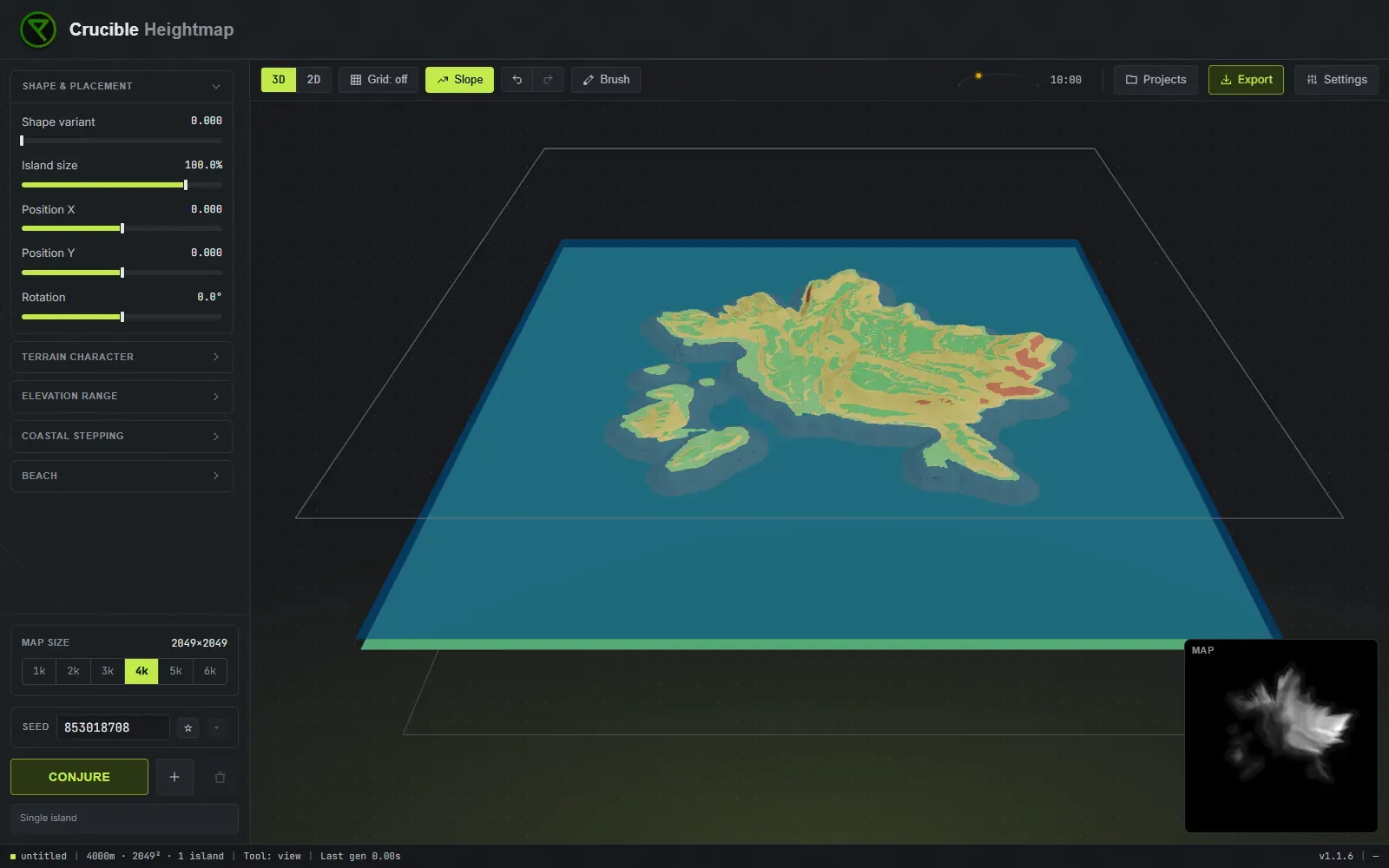
- Slope view: color-codes the terrain by how playable it is: green is flat, buildable ground, yellow is hilly terrain, orange marks cliffs, and red marks terrain so extreme the game cannot decorate it naturally. Use it to spot cliffs, verify buildable ground distribution, plan base locations, and catch terrain you may want to soften before building on it.
- Sun and time: change the light angle and sun position to preview how slopes and cliffs will shade in game. Helps you evaluate visual contrast and read the terrain better.
- Minimap: a small floating overview showing your whole map as a secondary view.
The preview updates as you move sliders or combine islands, so you shape the map with immediate feedback before you export. See Status bar for info on the indicators shown at the bottom of the workspace.